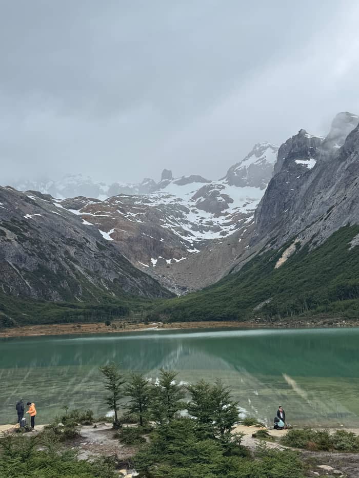
Door to door
Trek with pickup
Booked on this site
- RideAbout 30 min
- PickupYour hotel
- Day6 hours
Choose your stop
Find out about 14 stops
First pick a route, then tap any pin or stop for details and Google Maps.
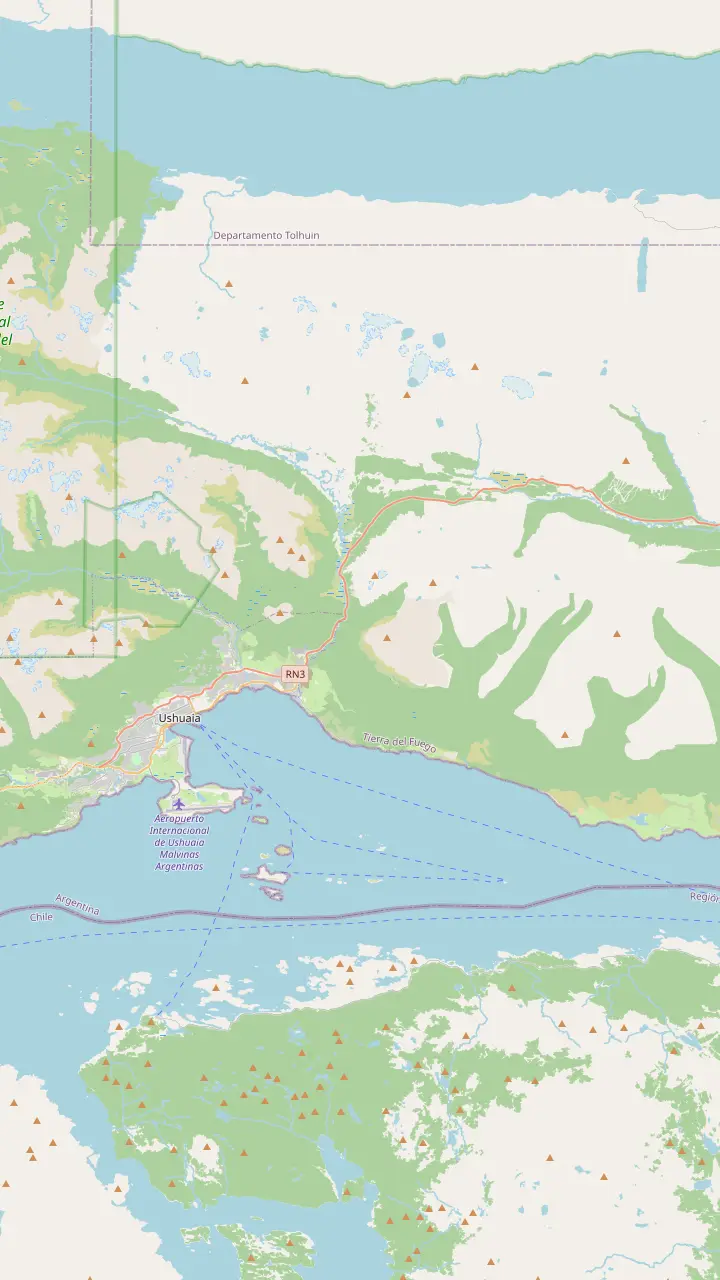
Capital of Tierra del Fuego, on the southern tip of Patagonia; tour pickups start from town hotels.
Google Maps5 km from town; no public bus runs to the centre, so it is taxi, remise or a transfer.
Google MapsIts own trail starts 1 km before the Esmeralda one: 4 km, 3 hours, 330 m of climb.
Google MapsThe walk starts here, on the left of Route 3 as you drive north, 18 km out by the city's count; look for the big car park.
Google MapsWinter centre 21 km from town, open daily 09:30 to 17:00, with snowshoes for rent in winter.
Google MapsRecreation centre 24 km out on Route 3 that rents snowshoes by the hour.
Google Maps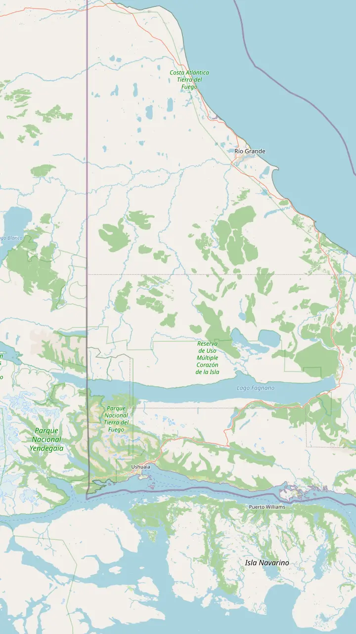
Capital of Tierra del Fuego, on the southern tip of Patagonia; tour pickups start from town hotels.
Google MapsThe meltwater lagoon at the head of the valley; its greenish tint comes from glacier sediment.
Google MapsCirque glacier at about 1,000 m, 7 km from the centre.
Google MapsThe Témpanos lagoon and Vinciguerra glacier: 14 km there and back, 8 hours, rated high difficulty.
Google MapsRoute 3 ends at this bay inside the national park.
Google MapsThe Alvear range separates this big lake from the Tierra Mayor valley.
Google MapsDirect flights from Buenos Aires land here as well as in Ushuaia.
Google Maps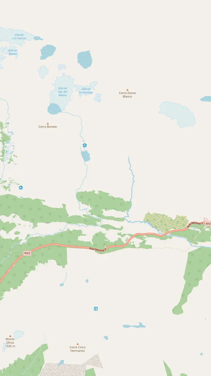
The walk starts here, on the left of Route 3 as you drive north, 18 km out by the city's count; look for the big car park.
Google MapsThe meltwater lagoon at the head of the valley; its greenish tint comes from glacier sediment.
Google MapsA 60-hectare glacier at 1,000 m; going past the lagoon to it is a climbers' route with an authorised guide.
Google MapsBonete hill and the Toribio range frame the view where the valley ends.
Google MapsIts own trail starts 1 km before the Esmeralda one: 4 km, 3 hours, 330 m of climb.
Google MapsWinter centre 21 km from town, open daily 09:30 to 17:00, with snowshoes for rent in winter.
Google MapsMap source: © OpenStreetMap contributors
The trail starts beside National Route 3, a short drive east of town. Here is how to get to Laguna Esmeralda from Ushuaia by tour van, transfer, taxi or your own car.
Editorial team, lagunaesmeraldatrek.quest · Updated November 9, 2026 · 7 min reading time
Key facts
The answer to how to get to Laguna Esmeralda from Ushuaia starts with one road. The path begins 18 kilometers from the city on National Route 3, on your left when heading north, according to the Ushuaia tourism office.1 You will not need to hunt for it: a large car park sits right beside the road at the entrance.2
The provincial tourism board places the start within the Tierra Mayor Valley reserve, also reached from Route 3 at 18 kilometers out.5 Visit Argentina, the national tourism body, gives 20 km instead.6 That reserve was planned as a tourist corridor laid out along the highway.7 Our map panel for this page marks the car park against the town and the airport. Along the way you pass other trail entrances and winter centres, so keep the distance from town in mind rather than turning in at the first car park you see.
The drive itself is part of the day. The city describes Route 3 here as a winding road climbing into the last mountains of the Andes, past glacial valleys of peat bog, lagoons and rivers.8 On a clear morning you leave the Beagle Channel behind within minutes and enter forest; on a grey one, cloud can sit low on the slopes. Either way, the turn-off comes sooner than the scenery suggests, so watch for the car park.
Ways to the trailhead
| Option | How it works | Good to know |
|---|---|---|
| Guided trek | Hotel pickup and van | From $99, guide and lunch |
| Private hike | Jeep or SUV from town | Viewpoint stop on the way |
| Transfer | Round trip with pickup | From $45, no guide named |
| Taxi or remis | Booked in town9 | Agree the return time |
| Hire car | Route 3, then the car park1,2 | Snow tyres in winter3 |
| Bicycle | Along Route 310 | Heavy traffic, patchy signal10 |
Listed fares are starting prices; taxi fares are agreed locally.
Letting the tour do the driving is the easiest plan. The trek we book starts at your hotel door in Ushuaia; the van then takes about 30 minutes to the first steps of the trail, and brings you back the same way at the end of the day. Nobody in your party has to find a meeting point or park a car, and the record puts the whole outing at 6 hours.
Other operators run similar pickups with small differences. One group trek counts 40 minutes in the van each way. Another collects guests from 8 AM, hotel by hotel, and confirms the time the evening before. Yet another picks up only at hotels with a reception, and gives guests in short-term rentals a nearby meeting point instead. If you are staying in an apartment, ask about this before you book.
A private hike does the same journey in a jeep or SUV, about 30 minutes from Ushuaia, pausing at the Carbajal Valley viewpoint on the way. For a family or a small group, that can be a relaxed way to reach the trailhead, with stops that follow your pace rather than a van timetable.
Time on the road
One-way ride time from town to the trail, as each listing states it.
If you want to walk on your own but not drive, book the ride alone. Transfers there and back cost from $45, with 6 hours set aside for the outing and pickup included. Its notes add lines worth repeating: do not go trekking alone, and always tell someone where you are going. Book it for a morning slot, and confirm the return time in writing with the operator the day before.
Taxis are part of normal life in Ushuaia, and the province lists taxi services alongside the urban bus lines.9 Locals also use the remis, a booked car with a driver, and the city tourism office names taxi, remise and transfer services as the ways out of the airport.11 For the trail, agree the price and the return time before you set off, and save the driver number.
The return leg is the weak point of a taxi plan. The car park is on a highway, not in a village, and the phone network along the trail is only partly available, according to the province.12 Fix a pickup time with a margin, and check for signal at the car park before your driver leaves; that way a muddy delay on the way down does not turn into a long wait by the road.
Which ride suits you
Match your plans to a line below and see which ride suits the day.
If I want guide, ride and lunch in one booking
The trek with pickup
Hotel pickup, about 30 minutes by van, from $99.
If We hike on our own but do not drive
A round-trip transfer
From $45, pickup included, return built in.
If We are a family who want our own car
A private hike
Jeep or SUV from town and a viewpoint stop on the way.
If I have a hire car
Drive Route 3
Park at the large car park 18 km out; snow tyres in winter.1,3
If I am staying in an apartment
Check the meeting point
Some operators pick up only at hotels with a reception.
Rides out
Door to door
Booked on this site
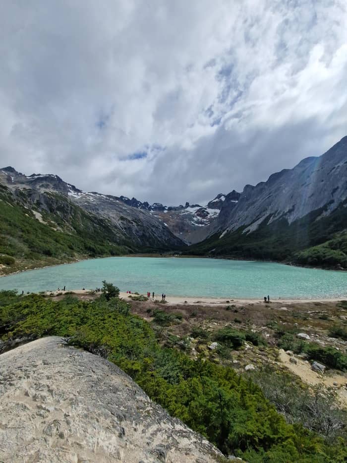
Your own car
Jeep or SUV
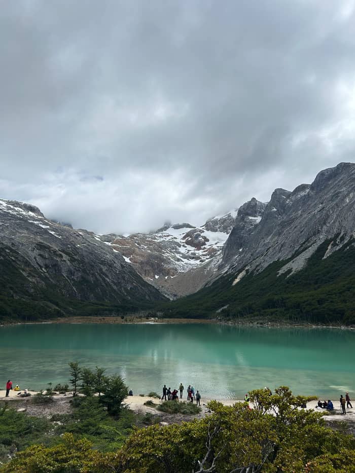
Ride only
Walk unguided
Ushuaia has urban bus lines, and the SUBE card works on them, the provincial tourism board notes.9 Those lines serve the town itself; for the 18 km out to the trail, plan on a transfer, a taxi or a car.5 A bus timetable is not something to build this day around. Ask your hotel desk which ride its guests use for the lagoon, and book it the evening before rather than at dawn.
The municipal transport sheet lists the intercity companies instead: buses from Ushuaia to Tolhuin and Rio Grande, and long-distance coaches to Rio Gallegos, El Calafate and Punta Arenas.41 Those services run along the same highway but sell tickets to towns, not to trailheads, and the sheet itself calls its prices reference figures only.41 They are useful for onward travel, not for a morning hike.
What the city does describe is a minibus option along the valley: agencies run minibuses with a guide to the main sights and scenic stops on the route.42 For walkers, the nearest thing to a bus to Laguna Esmeralda is a round-trip transfer like the one above, booked for your date, with the return built in.
The trip out and back
Pickup
The trek we book collects you in Ushuaia.
On Route 3
Out along Route 3 to the car park, 18 km from town.1
Trailhead
About 2 hours of guided hiking to the water.
At the lagoon
An hour for lunch, tea and photos.
Back down
About 2 hours down, then the ride to your hotel.
Spanish-speaking visitors sometimes look for a línea regular, a scheduled public service, to the trail. The official transport sheet lists town-to-town routes instead.41 For walkers on their own a hire car is the flexible alternative: the start time is yours, a real help with the trail rules below, and you can add Laguna Turquesa or a winter centre on the same road.
Winter changes the drive. Snow conditions run from June to October, and the city advises anyone renting a vehicle to check it has tyres fit for snow.43,3 It also says to set off in daylight and avoid driving when visibility is low.4 On a snowy morning, give yourself time: the car park can be icy, and the province flags ice and snow on the trails in the cold months.44
Cycling there is possible but serious. The province tells cyclists on Route 3 to expect changing weather, missing phone signal in places and a steady flow of heavy vehicles.10 A bike adds the climb out of town and the ride back after a muddy hike, so it suits strong riders on settled days only. Lock the bike to something solid at the car park and carry a light.
Video
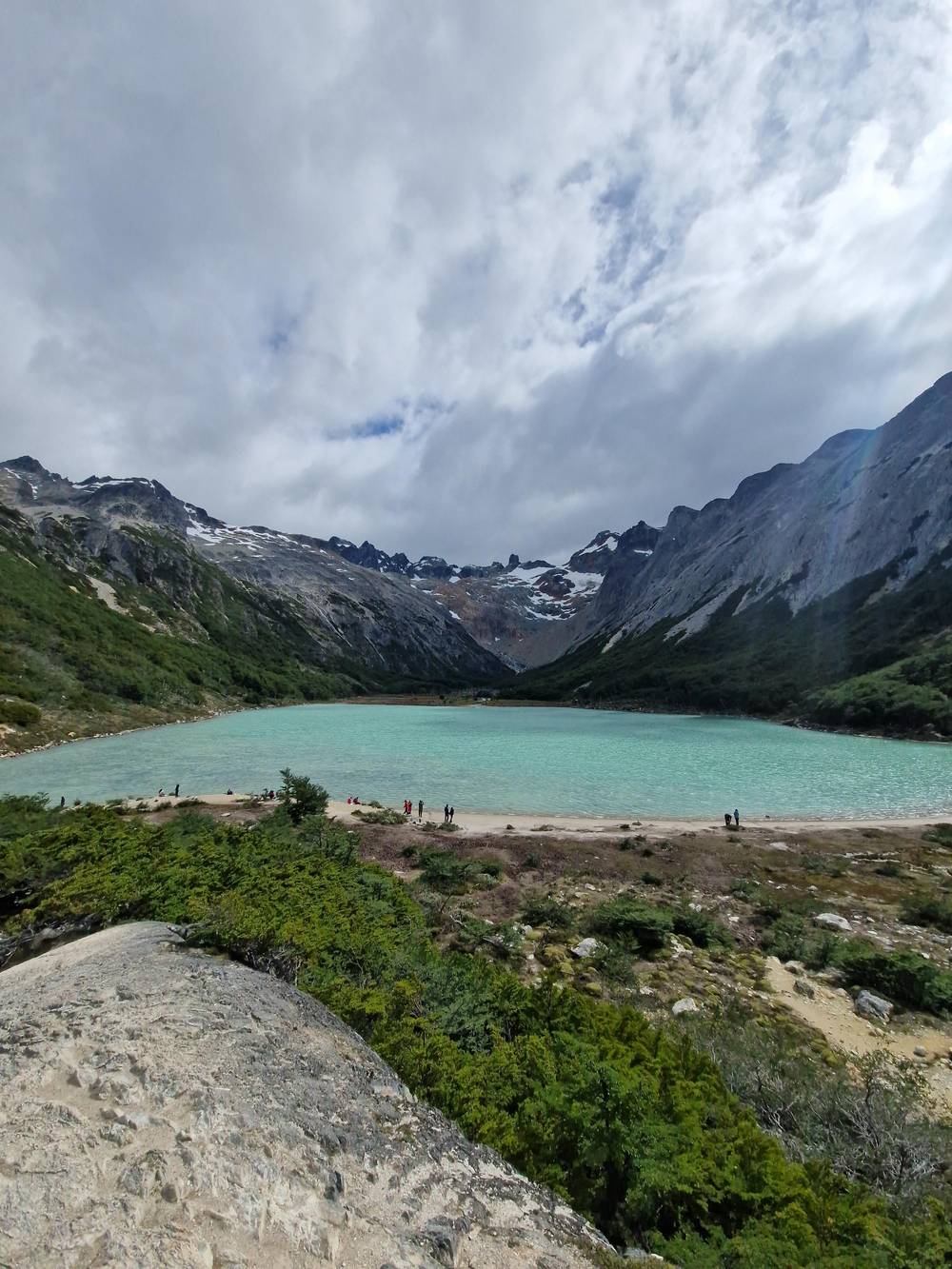
Dave Melonakos on YouTube · Nothing is fetched until you hit play.
The path to the Esmeralda Lagoon starts 18 kilometers from Ushuaia along the National Route No. 3 on the left bank (south-north direction).
Before you set off
The province sets entry cut-offs on this path, barring new starts after 3:00 PM from spring through summer and after 12:00 noon from autumn through winter.40 Work backwards from that. In winter, a midday cut-off with a ride of about 30 minutes means leaving town by late morning at the latest, and earlier is better.
Daylight is the other limit. In winter the sun rises at 9:30 and sets at 18:00, by the city count, so a walk of several hours leaves little slack.45 In summer the island enjoys 18 hours of daylight from the austral solstice on December 21, and the clock matters far less.46 Spring and autumn sit in between, with the shortening or lengthening days the season brings.
For the trek we book, the itinerary reads: walk up for 2 hours, rest at the water for 1 hour, walk down for 2 hours, with a van ride at each end. Independent walkers can plan the same: allow 4 to 5 hours on the trail, as the city does, and add the transport either side.47 That gives a realistic return time to leave with your hotel or your driver.
Malvinas Argentinas International Airport sits 5 km from town.48 The city stresses that no public transport links it with the centre, which leaves taxis, remis cars or booked transfers.11 Flying in and hiking on the same day is tight: drop your bags at the hotel first, and save the lagoon for a morning when the clock is on your side.
Cruise passengers face a fixed departure time, which favours a private hike with its own vehicle and a safety briefing at the trailhead. Whatever you choose, give the operator your ship and its all-aboard time when you book, and leave a wide margin for the mud and the ride back. A missed ship costs far more than a shortened walk, so agree with your guide in advance at which point you will turn around if the morning runs late.
If you arrive late in the day, use the evening to prepare. Rent boots in town if you need them, buy food for the next day, and ask your hotel to note the pickup time.49 The lagoon is a morning outing at heart, and in autumn and winter the official noon cut-off makes that a rule.40 Set an alarm, eat a real breakfast, and keep the afternoon free for drying boots and a hot shower back in town.
FAQ
The trail starts 18 kilometers from Ushuaia on National Route 3.1
The trek we book needs about 30 minutes by van from your hotel.
The province lists taxi services in Ushuaia; agree the return pickup before you go.9
Round-trip transfers are sold from $45, with pickup included.
Start before 3:00 PM from spring to summer, and before 12:00 noon from autumn to winter.40
The city advises checking that a rented vehicle has tyres fit for snow.3
Sources
Read on
Hiking to the green lagoon from Ushuaia? Ask a real person here.