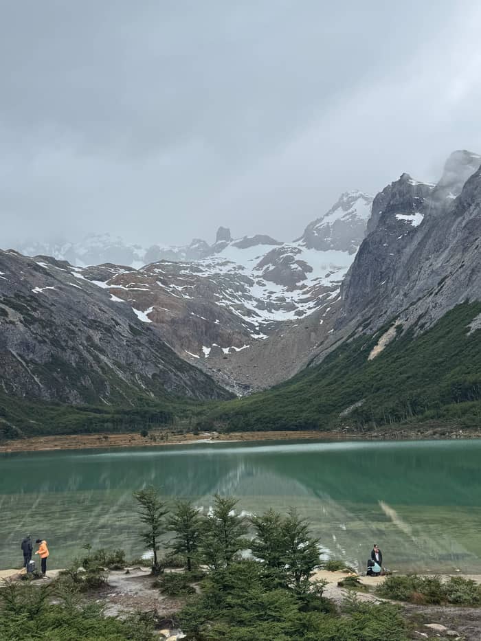
Short and steep
Laguna Turquesa
Across the same valley
- Return4 km
- Time3 hours
- Climb330 m
Choose your stop
Find out about 14 stops
First pick a route, then tap any pin or stop for details and Google Maps.
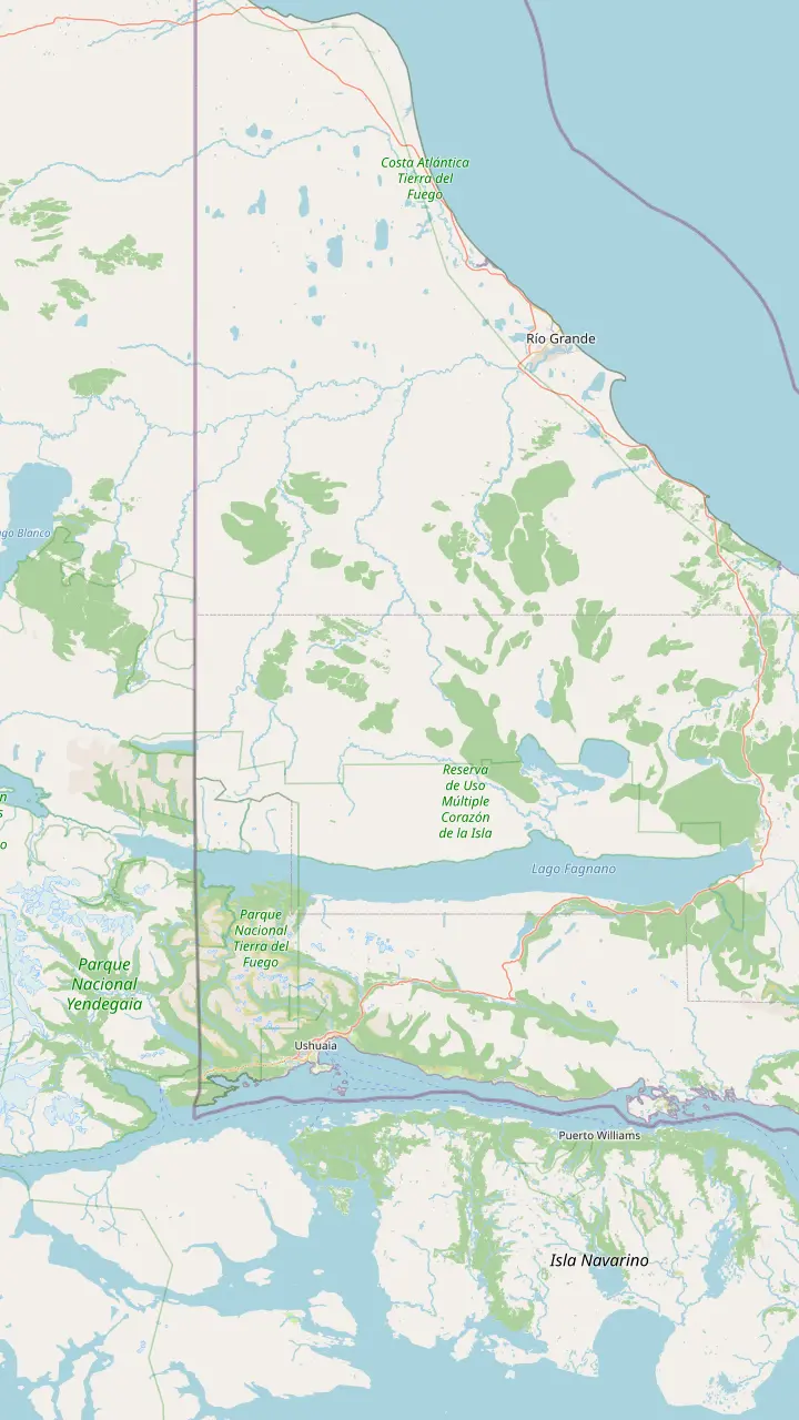
Capital of Tierra del Fuego, on the southern tip of Patagonia; tour pickups start from town hotels.
Google MapsThe meltwater lagoon at the head of the valley; its greenish tint comes from glacier sediment.
Google MapsCirque glacier at about 1,000 m, 7 km from the centre.
Google MapsThe Témpanos lagoon and Vinciguerra glacier: 14 km there and back, 8 hours, rated high difficulty.
Google MapsRoute 3 ends at this bay inside the national park.
Google MapsThe Alvear range separates this big lake from the Tierra Mayor valley.
Google MapsDirect flights from Buenos Aires land here as well as in Ushuaia.
Google Maps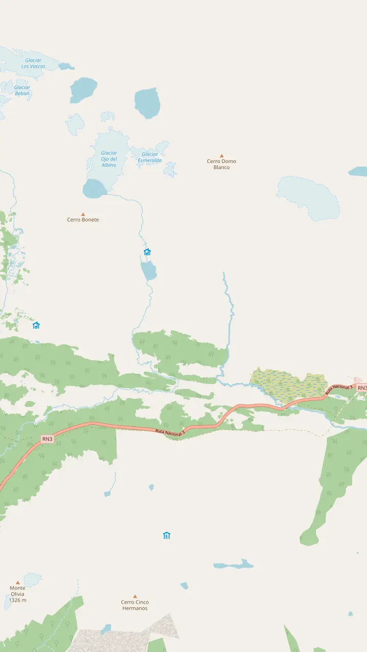
The walk starts here, on the left of Route 3 as you drive north, 18 km out by the city's count; look for the big car park.
Google MapsThe meltwater lagoon at the head of the valley; its greenish tint comes from glacier sediment.
Google MapsA 60-hectare glacier at 1,000 m; going past the lagoon to it is a climbers' route with an authorised guide.
Google MapsBonete hill and the Toribio range frame the view where the valley ends.
Google MapsIts own trail starts 1 km before the Esmeralda one: 4 km, 3 hours, 330 m of climb.
Google MapsWinter centre 21 km from town, open daily 09:30 to 17:00, with snowshoes for rent in winter.
Google Maps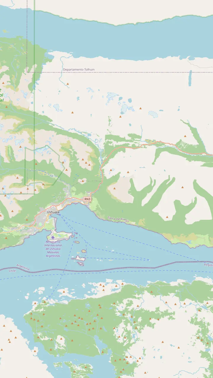
Capital of Tierra del Fuego, on the southern tip of Patagonia; tour pickups start from town hotels.
Google Maps5 km from town; no public bus runs to the centre, so it is taxi, remise or a transfer.
Google MapsIts own trail starts 1 km before the Esmeralda one: 4 km, 3 hours, 330 m of climb.
Google MapsThe walk starts here, on the left of Route 3 as you drive north, 18 km out by the city's count; look for the big car park.
Google MapsWinter centre 21 km from town, open daily 09:30 to 17:00, with snowshoes for rent in winter.
Google MapsRecreation centre 24 km out on Route 3 that rents snowshoes by the hour.
Google MapsMap source: © OpenStreetMap contributors
Is Ushuaia in Patagonia? Yes: the city sits at Patagonia's southern tip, on an island shared with Chile. Laguna Esmeralda lies in a valley just east of town.
Editorial team, lagunaesmeraldatrek.quest · Updated November 9, 2026 · 8 min reading time
Key facts
Is Ushuaia in Patagonia? Yes. Ushuaia's own tourism office places the city at Patagonia's southern tip, where Argentina itself runs out, and that is where the end of the world tag comes from.1 Visit Argentina, the national tourism body, lists Laguna Esmeralda's location in the same terms: the Province of Tierra del Fuego, Argentinian Patagonia.7 So the lagoon walk is a Patagonian hike in every official sense.
What makes the answer feel less obvious is the water in between. Ushuaia is not on the mainland at all but on the island of Tierra del Fuego, which the Strait of Magellan separates from the rest of the continent.8 Ushuaia is also the provincial capital, so it is both the seat of government and the base for almost every visit to the lagoon.9 Ask anyone in town whether they live in Patagonia and the answer is an easy yes, island or not.
The distances underline how far south you are. InFueTur, the provincial tourism board, puts Ushuaia 3,079 km from Buenos Aires and 1,000 km from the Antarctic Peninsula.6 At this latitude the light and the weather feel very different from northern Patagonia, with long summer evenings and short winter days. For the Esmeralda walk, the practical effect is a short summer, a long winter and a climate that changes by the hour.
Compare the walks
| Trail | From the city | Return distance | Time | Climb |
|---|---|---|---|---|
| Laguna Esmeralda | 18 km | 9 km | 4 to 5 hours | 220 m |
| Laguna Turquesa | 17 km | 4 km | 3 hours | 330 m |
| Témpanos and Vinciguerra | 7 km | 14 km | 8 hours | 350 m |
| Martial viewpoint | 7 km | 2500 m | 75 minutes | 220 m |
All figures from Ushuaia's tourism secretariat trail pages.4,25,26,27,24,28,29,30,22,31,32,33,21,34
Tierra del Fuego is an island divided between Argentina and Chile, according to InFueTur.2 Argentina holds the eastern part and Chile the western part.15 The Argentine part, including Isla de los Estados, covers 21,571 square kilometres.16 Ushuaia sits on its south coast, facing the Beagle Channel, while the mountains behind the city, where the lagoon lies, are the last ridges of the Andes.
That split shapes how people arrive by road. To drive onto the island from mainland Argentina you have to cross 2 borders with Chile.17 From Río Gallegos it is about 68 km to the Integración Austral crossing, then a ferry over the Strait of Magellan from Punta Delgada to Bahía Azul.11,18 InFueTur gives the crossing as about 30 minutes, adding that the ferry depends on the weather.12 Build slack into any road trip for a missed crossing, and check border opening times before you set off.
From Bahía Azul it is 148 km to the San Sebastián border post and the return to Argentina.13 Ushuaia's tourism office puts the city 293 km beyond that point.14 National Route 3 then carries on through the city and out to Bahía Lapataia in the national park, where its 3,079 km end.19 Laguna Esmeralda sits just off this same road, so drivers pass its car park on the way in. If you arrive by car from the north, you can stop for the walk before you even check in.
Laguna Esmeralda lies in the mountains north-east of the city, in the valley that Route 3 follows inland. Ushuaia's tourism office puts the start of the path 18 km from the city, on the left side of the road heading north, beside a large car park.4,38 Visit Argentina gives 20 km.5 The map panels below show the trailhead, the lagoon and the glacier above it, and each pin opens in Google Maps.
Ask a local, in Spanish, Laguna Esmeralda Ushuaia dónde queda, and the answer will be the Tierra Mayor valley. InFueTur files the trail under the provincial reserve of the Valle Tierra Mayor, entered from Route 3.3 From the car park, the return walk measures 9 km according to the city and 8.6 km according to the province.25,39 Locals simply call it the Esmeralda, and any driver or hotel desk in town will know the turn-off. Writing the reserve's name on your phone helps if your Spanish is limited.
Getting to the start is simple by car, taxi or tour. Ushuaia's taxis run on a meter, while remises charge a fixed rate and are booked by phone.40 Our site tour picks you up at your Ushuaia hotel and drives roughly half an hour to the car park. The page on getting to the trailhead covers buses, timings and return pickups in more detail, so this one stays with the map and the wider geography of the island.
Plan the trip
Choose by how much time and energy you have left.
If I have a spare half day
Martial glacier
The viewpoint loop takes 75 minutes, 7 km from the centre.34,21
If I want the opposite view
Laguna Turquesa
It faces Laguna Esmeralda across the Tierra Mayor valley.35
If I want a big mountain day
Témpanos with a guide
If I want sea and forest
Tierra del Fuego National Park
It lies 12 km west of the city, on the coast.23
If I have only one day
Laguna Esmeralda
The city counts it among its most recommended treks.37
A second day out
Short and steep
Across the same valley
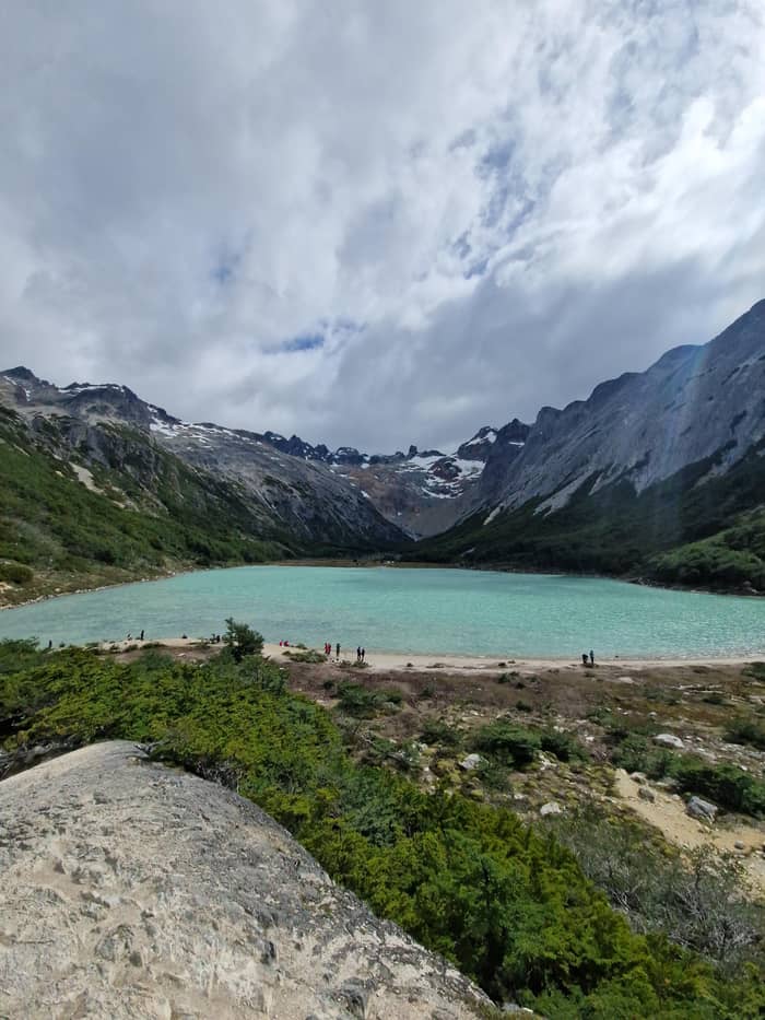
Half day
Above the city
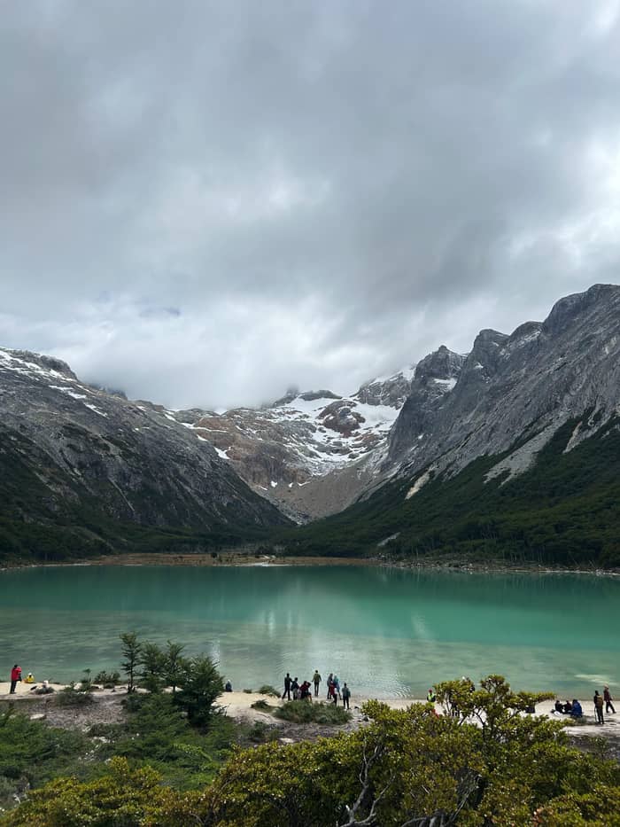
Full day
Andorra Valley
The reserve that holds the trail was created in 1994 by Provincial Decree 2256/1994, for exclusively tourist use.58 InFueTur describes it as a tourist corridor laid out along Route 3, covering about 370 km2, about 40 km long and about 8 km wide on average.59,60 Its main value, in the province's words, is scenic beauty.61 From Ushuaia it is reached by driving 20 km north on Route 3.62 The Esmeralda and Turquesa trails both start inside it.63
The reserve's trekking trails include the Beban waterfall, Laguna Esmeralda, Laguna Turquesa, and the Submarino waterfall and lagoon.63 Laguna Turquesa is the nearest neighbour: its trail starts 17 km from Ushuaia, 1 km before the Esmeralda start, on the other side of the road.24 The lagoons face each other across the valley floor, so the reserve is easy to explore over several mornings.
The valley itself is glacial in origin, crossed by the meandering Lasifashaj River that flows out near Estancia Harberton.64 The Alvear range rises between the valley and Lake Fagnano to the north, and the Sierra de Sorondo blocks it off from the Beagle Channel to the south.53 On the map that makes the lagoon a pocket of high ground between Lake Fagnano and the island's southern channel, a short drive from the coast but a world away in feel.
The road south
Buenos Aires
The road runs south along the Patagonian coast.10
Río Gallegos
About 68 km to the Integración Austral crossing.11
Punta Delgada
About 30 minutes over the Strait of Magellan.12
Bahía Azul
148 km to the San Sebastián border.13
San Sebastián
Ushuaia is 293 km further on.14
Ushuaia
The trailhead is 18 km beyond the city.4
The mountains around the lagoon are the southern end of the Andes. Ushuaia's tourism office describes Route 3 winding into that final stretch of the range, through glacial valleys with peat bogs, lagoons and rivers.65 The peaks are not very high, but the city notes that climate and relief make trekking here harder than the numbers suggest, and recommends specialised guides.66 Snow can lie on the upper slopes well into spring, even when the city below is clear.
Heights on the official pages vary with what they measure. Visit Argentina gives the lagoon walk an altitude of 450 m, while InFueTur puts the upper trail, which it calls high mountain terrain, at 600 m on average.67,68 Above the lagoon the Ojo del Albino Glacier reaches 1,000 m.43 The Martial glacier above the city sits at about the same height.52 In other words, the ice you see from the shore stands roughly as high as the glacier that overlooks the town.
Visit Argentina promises a panorama of Bonete hill and the Toribio range where the valley closes.45 Both are marked on the trail panel above. Seen from the lagoon shore, they close the valley like a wall. It is a compact landscape: forest, bog, lake and ice sit within a few hours' walk of the road, which is what makes this valley such a rewarding first hike on the island.
Video
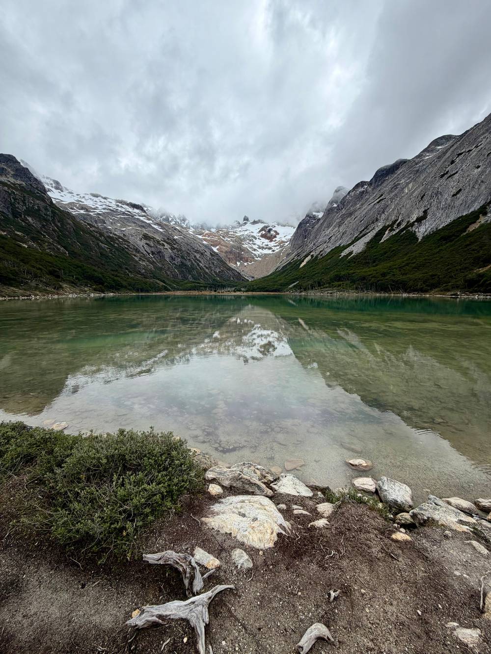
Samuel and Audrey on YouTube · Nothing is fetched until you hit play.
Tierra del Fuego is an island separated from the American continent by the Strait of Magellan and its territory is divided between Argentina and Chile
Arriving in Ushuaia
If the lagoon leaves you wanting more, the city has several walks within easy reach. The Martial glacier is 7 km from the centre, inside a natural reserve of the same name.21 Its glacier viewpoint circuit covers 2500 m with 220 m of climb in 75 minutes.34 In winter the same slopes are used for alpine skiing and snowboarding.69 It is the easy add-on for a half day, and the views over the city and the channel are a good contrast with the closed valley of the lagoon.
For a longer and harder day, the route to Laguna de los Témpanos and the Vinciguerra glacier starts 7 km from the city, through the Andorra Valley.22 The city lists it at 14 km there and back, 8 hours and 350 m of height difference, on high-difficulty terrain.31,32,33,36 Its glacier and peat bogs form a Ramsar wetland site.70 Go with a guide unless you are an experienced mountain walker, and allow a full day with an early start.
West of the city lies Tierra del Fuego National Park, created in September 1960, 12 km from Ushuaia and the only national park in Argentina on the sea.71,23 It protects 68,909 hectares.72 At Lapataia, a sign marks 3,063 km to Buenos Aires.73 The Beagle Channel boat trips and penguin colonies are a separate day out, covered by our sister site on Ushuaia penguin tours. Together with the lagoon, they make a well-rounded few days.
Flying is the quick way in. InFueTur gives direct flights from Buenos Aires to Ushuaia and Río Grande of about three and a half hours, while Ushuaia's tourism office gives the flight as 3 hours.54,74 Ushuaia's Malvinas Argentinas International Airport is 5 km from town.20 Río Grande's airport, in the north of the island, lies 7 km from that city's centre.75 From there it is a long drive south, so fly into Ushuaia if the lagoon is your main goal.
There is no public transport from Ushuaia airport into town, so the options are taxi, remise or a booked transfer.51 Bring nothing fresh in your luggage: SENASA, Argentina's food safety service, checks arrivals at both airports, and travellers are asked not to carry homemade food, fruit and vegetables, cheese or cold cuts.55 Finish your snacks on the plane.
Once in town, the lagoon is a morning's drive or a booked tour away. Laguna Esmeralda, Ushuaia, Tierra del Fuego: that full address puts the walk at the bottom of the Americas, yet the trailhead is only a short drive from your hotel. Spend a day settling in, check the forecast and pick a clear morning for the hike. If the weather turns, the city's museums and the waterfront fill a spare day easily.
FAQ
Ushuaia's tourism office places the city at the southern tip of Patagonia.1
It lies in the province of Tierra del Fuego, in Argentinian Patagonia.7
It sits in the provincial Valle Tierra Mayor reserve, off Route 3.3
It is separated from the continent by the Strait of Magellan and shared with Chile.2
InFueTur gives 1,000 km from Ushuaia to the Antarctic Peninsula.6
Sources
Read on
Hiking to the green lagoon from Ushuaia? Ask a real person here.