Small group
Emerald Lagoon trek
Our site tour, lunch at the shore
- Length6 hours
- PickupHotel in Ushuaia
- GearPoles, crampons if needed
Choose your stop
Find out about 14 stops
First pick a route, then tap any pin or stop for details and Google Maps.
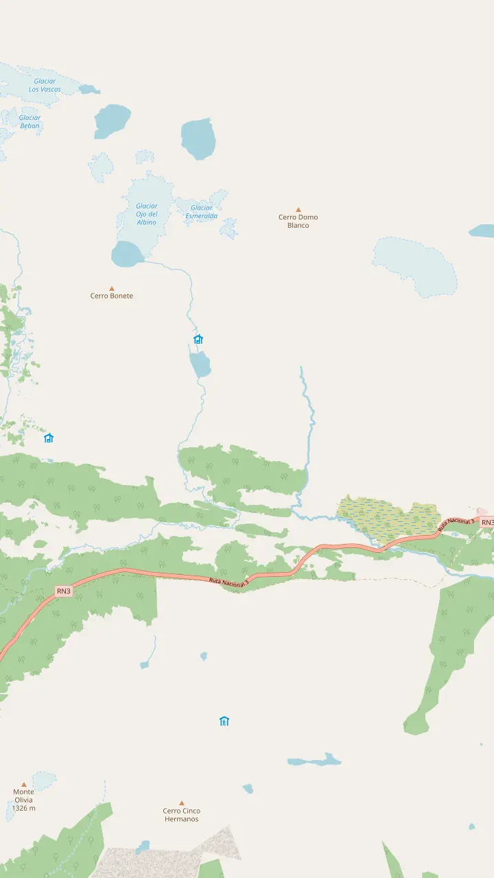
The walk starts here, on the left of Route 3 as you drive north, 18 km out by the city's count; look for the big car park.
Google MapsThe meltwater lagoon at the head of the valley; its greenish tint comes from glacier sediment.
Google MapsA 60-hectare glacier at 1,000 m; going past the lagoon to it is a climbers' route with an authorised guide.
Google MapsBonete hill and the Toribio range frame the view where the valley ends.
Google MapsIts own trail starts 1 km before the Esmeralda one: 4 km, 3 hours, 330 m of climb.
Google MapsWinter centre 21 km from town, open daily 09:30 to 17:00, with snowshoes for rent in winter.
Google Maps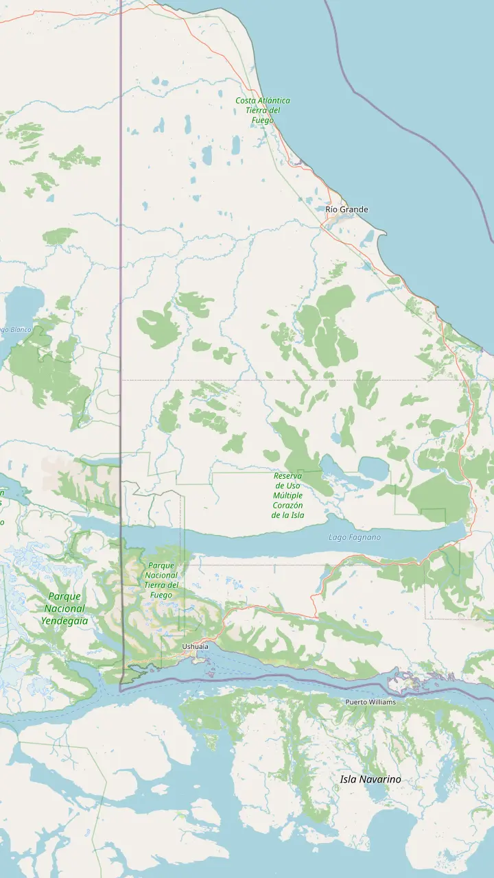
Capital of Tierra del Fuego, on the southern tip of Patagonia; tour pickups start from town hotels.
Google MapsThe meltwater lagoon at the head of the valley; its greenish tint comes from glacier sediment.
Google MapsCirque glacier at about 1,000 m, 7 km from the centre.
Google MapsThe Témpanos lagoon and Vinciguerra glacier: 14 km there and back, 8 hours, rated high difficulty.
Google MapsRoute 3 ends at this bay inside the national park.
Google MapsThe Alvear range separates this big lake from the Tierra Mayor valley.
Google MapsDirect flights from Buenos Aires land here as well as in Ushuaia.
Google Maps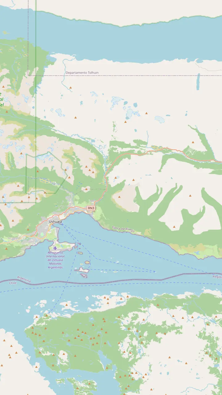
Capital of Tierra del Fuego, on the southern tip of Patagonia; tour pickups start from town hotels.
Google Maps5 km from town; no public bus runs to the centre, so it is taxi, remise or a transfer.
Google MapsIts own trail starts 1 km before the Esmeralda one: 4 km, 3 hours, 330 m of climb.
Google MapsThe walk starts here, on the left of Route 3 as you drive north, 18 km out by the city's count; look for the big car park.
Google MapsWinter centre 21 km from town, open daily 09:30 to 17:00, with snowshoes for rent in winter.
Google MapsRecreation centre 24 km out on Route 3 that rents snowshoes by the hour.
Google MapsMap source: © OpenStreetMap contributors
Use this Laguna Esmeralda Ushuaia trail map to read the walk before you lace up: where it leaves Route 3, how the forest gives way to bog, and what waits at the lagoon.
Editorial team, lagunaesmeraldatrek.quest · Updated November 9, 2026 · 8 min reading time
Key facts
This Laguna Esmeralda Ushuaia trail map follows one path out and the same path back. Ushuaia's tourism secretariat measures it at 9 km for the round trip, with a height difference of 220 m and 4 to 5 hours of walking.1,5,3 It rates the ground medium to easy and the physical demand medium, which is a fair way to say the gradient is gentle and the footing is not.10,11 Plan the day around that footing rather than around the distance.
The provincial tourism board, InFueTur, gives slightly different numbers: 8.6 km and 5 hours, on a signposted route that returns the way it came.2,4,12,13 The two bodies simply publish different figures. Searching laguna esmeralda trekking distancia in Spanish brings up both, so do not be surprised when a guide quotes one and a sign suggests the other. Either way the walk fits comfortably into a morning and an early afternoon.
Phone coverage on the trail is partial, so download this page or an offline map before you leave town.14 This page's map panels mark the trailhead on Route 3, the lagoon at the top of the valley and the glacier that feeds it, plus the Laguna Turquesa start just down the road. Each pin opens in Google Maps. Read the sections below in order and you will know what the ground does next at every stage of the walk.
Official figures
| Measure | Ushuaia tourism office | InFueTur | Visit Argentina |
|---|---|---|---|
| Length | 9 km return | 8.6 km return | Not given |
| Walking time | 4 to 5 hours | 5 hours | Not given |
| Height gain | 220 m | Not given | Not given |
| Height | Not given | 600 m average, upper part | 450 m |
| Start from Ushuaia | 18 km | 18 km | 20 km |
| Rating | Medium to easy ground | Medium | Not given |
Each body's own published figures; where they differ, both are shown.1,3,5,10,2,4,18,30,31,20
The path leaves National Route 3 on the left-hand side as you drive north out of Ushuaia, 18 km from the city by the tourism secretariat's reckoning.6 A large car park beside the road marks the entrance, which makes it hard to miss.7 Visit Argentina, the national tourism body, puts the start 20 km out and ties it to the Altos del Valle winter sports centre, so any of those landmarks will get you there.20,21
Its Spanish name is the Sendero Laguna Esmeralda; Ushuaia's tourism office counts it among the most recommended treks around the city for anyone with only a few days to spare.22 That popularity matters at the trailhead: InFueTur notes a steady flow of hikers all year, so arrive early if you want the forest quiet and a parking space close to the path.23 Starting soon after breakfast also leaves a margin for slow going in the bog, a long lunch at the shore and the walk back, all well before the afternoon cut-off.
Do not confuse it with the Laguna Turquesa trail, which starts 1 km earlier on the right-hand side of the road as you head north.24 The lagoons face each other across the Tierra Mayor valley, and from the Turquesa side you can pick out Laguna Esmeralda in the distance.25,26 If a driver drops you off, name the Esmeralda car park, not just the valley, so you start on the correct side of the road and do not end up climbing the steeper slope opposite by mistake.
The walk opens under lenga, the native southern beech that dominates the first part of the trail.15 In Argentina's national biodiversity system the lenga is described as a deciduous tree that can reach 30 m, growing short and shrubby where wind and altitude press on it.39 Here, low in the valley, the trunks are tall and the canopy closes overhead, which keeps the path shaded and often damp even on dry days.
Visit Argentina sums up the sequence well: through a forest, across a peat bog and over a brook on a log bridge before the lagoon comes into view.16 In the forest the risks are roots and slick soil rather than steep ground. Take shorter steps, keep your weight over your feet and use the poles you brought or the ones a tour hands out. The provincial board lists walking sticks among the year-round essentials for exactly this reason.40
Look up as well as down. The forest is a good place to hear a woodpecker drumming on a quiet morning, and the national parks' species file says the male Magellanic woodpecker drums loudly on hollow trunks.41 It is a large black bird, 45 cm long, and the male carries a red head and crest.42,43 Stop when you hear it, because the sound carries far and the bird is usually closer to the path than you think.
Choose your way
Match the trail to your experience and the season.
If It is my first hike in Tierra del Fuego
Go with a guide
Both the city and the province recommend an agency or guide for safety.32,33
If I hike often and know boggy ground
Walk it yourself, early
Start before the cut-off and never alone, as the provincial leaflet asks.8,34
If I want the glacier too
Book a separate guided day
InFueTur says the glacier ascent needs climbing experience and an authorised guide.35,36
If I am going in autumn or winter
Start before noon
The province asks walkers not to enter after 12:00 noon in those seasons.9
If I want a shorter walk nearby
Try Laguna Turquesa
Walk it with a guide
Small group
Our site tour, lunch at the shore
Guided
Guided walk with pickup
Transport only
Ride to the trail, walk alone
Beyond the trees the valley floor opens up. InFueTur describes the middle of the walk as stretches where foliage and peat bog alternate, and the Tierra Mayor valley as a whole is largely occupied by Sphagnum bogs.18,17 Underfoot that means a spongy, saturated surface that can swallow a boot to the ankle. Ushuaia's own description of the route names this bog as the trail's second stage, after the forest.66
Keep to the trodden line here. Detours around a muddy patch widen the scar on the bog and often lead into deeper water. InFueTur warns that much of the trail runs over wet and slippery ground and lists boots, waterproofs, walking poles and warm clothing as year-round needs.40 Gaiters help, and so does accepting that you will get muddy and walking straight through rather than balancing on tussocks.
This is also beaver country. Beavers were brought to the Argentine side of Tierra del Fuego in 1945-1946 for fur, and their dams can reach 5 m in height.67,68 Along the valley you pass ponds and drowned trees that are the work of these engineers. The animals are mostly nocturnal, so you are more likely to see a lodge or a gnawed stump than a beaver itself.69 The page on the lagoon's colour and wildlife tells their full story.
Stage by stage
Car park
Start on the left of the road heading north, by the large car park.6,7
Forest
Shaded beech forest, roots and damp soil.15
Brook
A stream crossed on a log on the way to the bog.16
Valley floor
Spongy Sphagnum bog across the valley floor.17
Upper valley
The path rises into high mountain terrain.18
Shore
Green water from glacier sediment; rest, eat and turn back.19
After the bog the trail starts to gain height in earnest. Ushuaia's tourism office describes the route as climbing to the meltwater lagoon once the forest and bog are behind you.66 InFueTur calls this upper part a high mountain environment, with an average height of 600 m above sea level, while Visit Argentina lists an altitude of 450 m.18,31 The two bodies publish different figures; what you feel is a steady pull with looser rock underfoot.
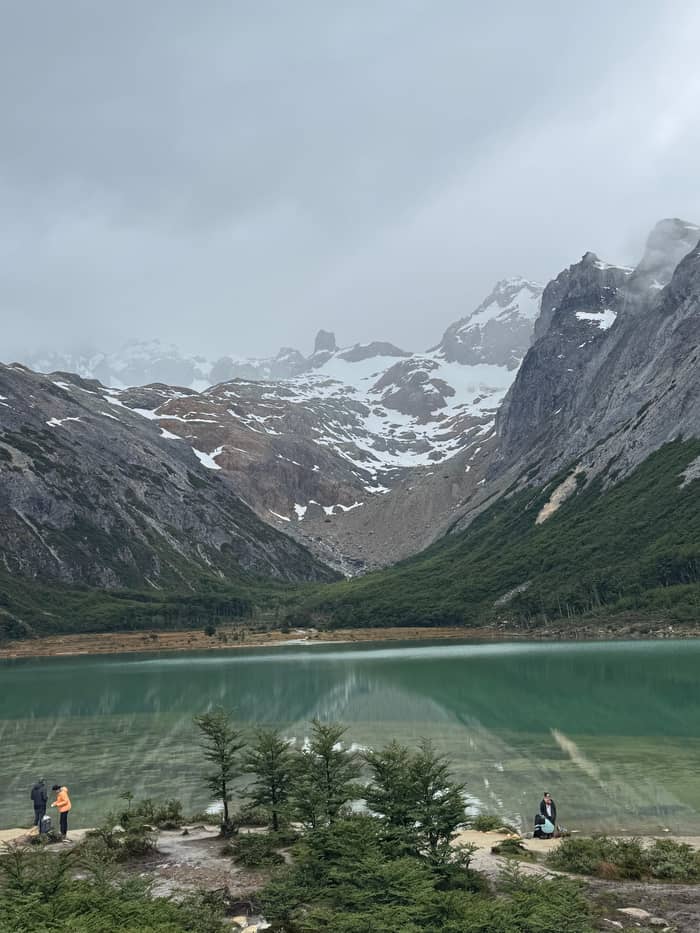
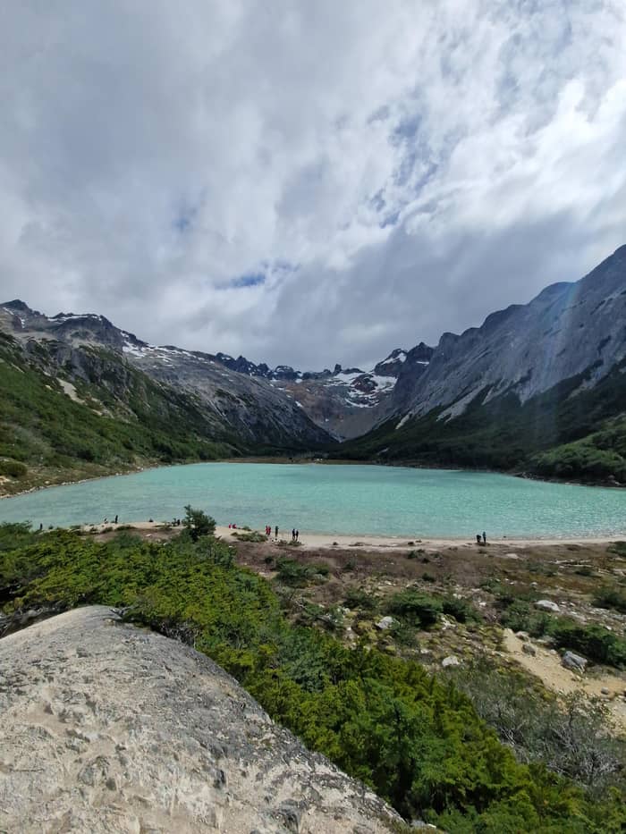
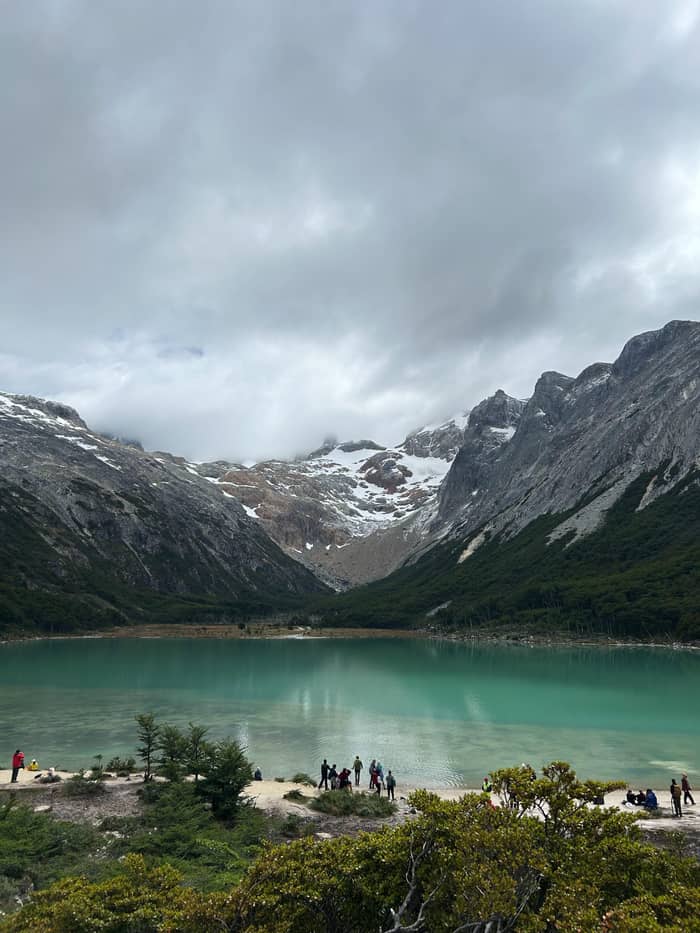
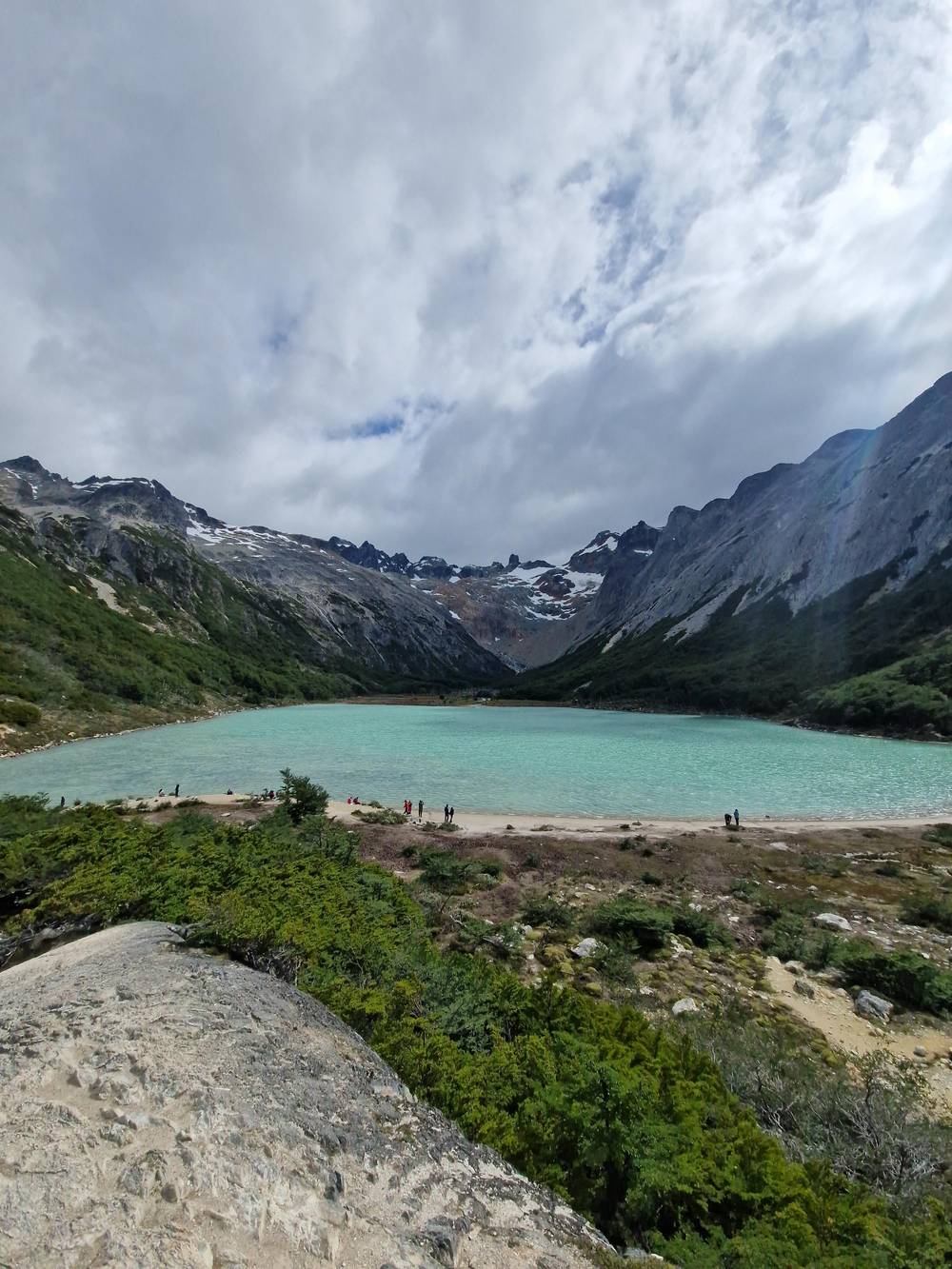
Then the valley ends and the water appears. InFueTur credits the colour to rock sediment that the Ojo del Albino Glacier above sends down into the water.19 Visit Argentina describes snow peaks reflected in the surface on a calm day and a wide view of the Toribio range and Bonete hill at the head of the valley.70,46 Find a dry rock, put on a layer before you cool down and give yourself time to watch the colour shift as clouds pass.
This is the natural lunch stop. On our site tour the itinerary allows 1 hour at the lagoon for lunch, tea and photos before the walk back. If you are on your own, carry the same: food, a hot drink and a spare warm top. The wind often funnels down from the glacier, and a sunny lakeshore can feel wintry within minutes. Pack out everything you bring, including fruit peel, because the reserve exists to keep this place as it is.
Video
Sumit Everywhere on YouTube · Nothing is fetched until you hit play.
Hikers are requested not to destroy or steal the signs and signals, as they are essential to avoid getting lost and accidents
Before the trailhead
From the lagoon a fainter route continues toward the Ojo del Albino Glacier. InFueTur notes that hikers heading for the glacier share the Laguna Esmeralda trail as far as the water.71 Visit Argentina describes that continuation as a frozen path of more than 20 km in total, climbing through rock formations to a glacier of 60 hectares at 1,000 m.72,44,45 It is a different undertaking from the lagoon walk.
The province is blunt about it. People without climbing experience and technical equipment should not attempt the ascent, which InFueTur classes as high risk and high difficulty, to be done only under an authorised mountain guide.35,36 Ice and rock fall make the area hard to reach, which can slow a rescue team if something goes wrong.73 If the glacier tempts you, book it as its own guided day.
One more warning applies across the province: entering ice caves under glaciers is strictly forbidden, because ice and rock fall from them throughout the year, according to InFueTur's hiking leaflet.74 Photographs from inside such caves circulate online, but they are not an invitation. For the lagoon walk itself, the sensible turnaround is the shoreline, which is where the map's main trail ends.
The trail sits inside the Valle Tierra Mayor Natural and Landscape Reserve, a provincial protected area along Route 3.30 Rules are few and clear. Do not take pets or play music, because the flow of hikers is heavy all year.23 Do not damage or remove signs, which exist to stop people getting lost.38 Fire is forbidden on Ushuaia's trails, and only a stove is allowed.65 The provincial leaflet also keeps quad bikes and motorbikes off the paths.75 None of this is unusual, but the reserve is busy, and small habits multiplied by many walkers decide how the bog and the shore look next season.
Timing is the rule people break most. InFueTur asks hikers not to enter the trail after 3:00 PM in spring and summer, or after noon in autumn and winter.8,9 Those cut-offs leave enough light to get back to the road at a normal pace. The provincial hiking leaflet adds that an early start gives you more safety, and that you should never walk alone.76,34 In practice, if you reach the car park after lunch in midsummer, consider the Turquesa trail or a valley stroll instead, and keep the lagoon for an early start the next morning.
If something goes wrong, the emergency number on the trail is 103.64 Ushuaia's tourism office also lists Civil Defence on 103 or 911, with VHF radio 148.615 for those who carry one.77 Although the trail is rated medium, both the city and the province recommend going with a specialised agency or guide for safety.32,33 Tell someone in town your plan and your expected time back before you set off; that simple step is what turns a twisted ankle into a short wait rather than a long night.
FAQ
InFueTur rates the glacier ascent high risk and says it needs an authorised mountain guide.36
InFueTur describes the network as partial, so carry an offline map.14
Sources
Read on
Hiking to the green lagoon from Ushuaia? Ask a real person here.