Start
Lenga forest
Shade, roots, woodpeckers
- TreeLenga, up to 30 m
- Look forWoodpecker holes
- AutumnLeaves turn reddish
Interactive tick list
Things to do · 9 items
Work through the list and tick items. Progress is saved on this device.
0 / 9 ready
Ready to go. Only the date and the number of hikers are left to choose.
Hold a seatThe Emerald Lagoon in Ushuaia owes its colour to a glacier above it. On the way up you cross a valley carved by ice, spongy bogs and the work of imported beavers.
Editorial team, lagunaesmeraldatrek.quest · Updated November 9, 2026 · 8 min reading time
Key facts
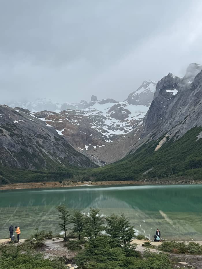
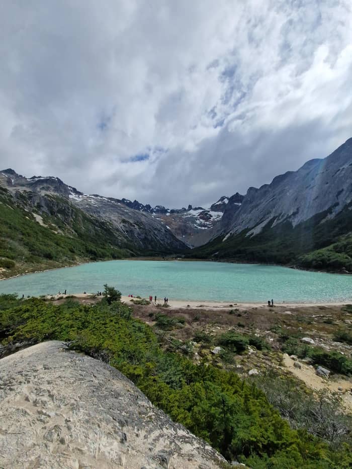
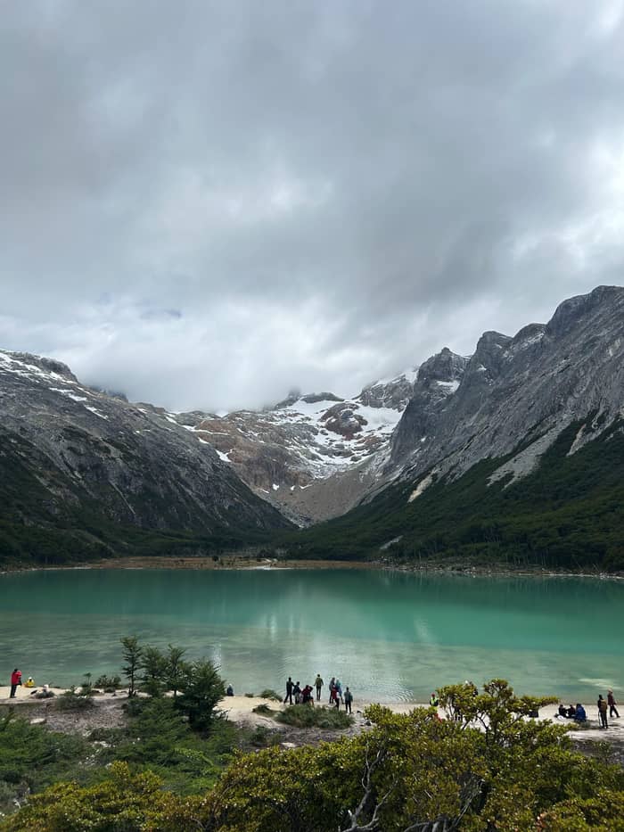
The Emerald Lagoon in Ushuaia gets its name honestly. InFueTur, the provincial tourism board, explains that the greenish colour of the water comes from sediment carried down from the Ojo del Albino Glacier.1 Ushuaia's own tourism office calls it a meltwater lagoon, reached after the forest and the bog.7 In other words, the lagoon is a settling pond for the glacier above, and the colour is the glacier's signature.
Fine rock dust held in suspension is what gives glacial lakes their milky green or blue look, and the shade shifts with the light, the season and how much meltwater is arriving. Visit Argentina, the national tourism body, goes for turquoise rather than green in its description of the water.8 So is Laguna Esmeralda in Ushuaia a turquoise lake or an emerald one? Both, depending on the hour and the sky, and neither label is wrong.
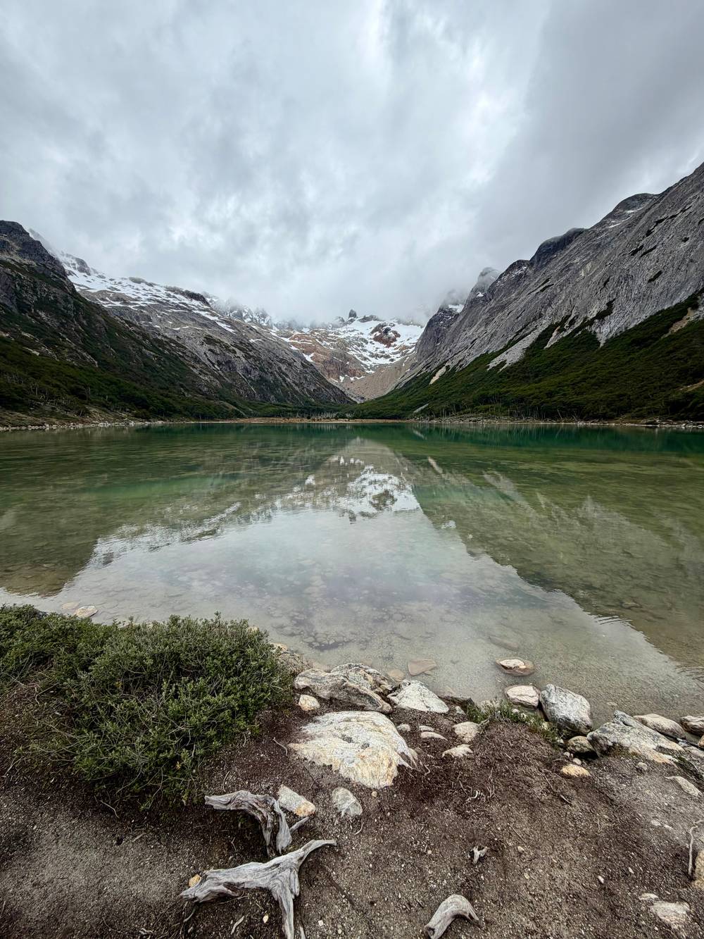
Calm conditions add a second effect, the mirror image of the snowy peaks that Visit Argentina mentions, which appears only when the wind drops.9 Clouds flatten the colour into grey-green, while sun lifts it toward turquoise. If you want the strongest colour, sit on the shore for a while rather than taking one photograph and leaving; the water changes as the light moves across the valley.
Who's who
| Species | Spanish name | Where to look | Note |
|---|---|---|---|
| Lenga beech | Lenga | Forest at the start | Turns reddish in autumn |
| Antarctic beech | Ñire | Cold, poor slopes | Turns red in autumn |
| Sphagnum moss | Turba | Valley floor bogs | Holds water like a sponge |
| Beaver | Castor | Ponds and dams | Introduced, mostly nocturnal |
| Magellanic woodpecker | Carpintero gigante | Forest trunks | Listed Vulnerable |
| Upland goose | Cauquén común | Wet meadows | Grazes in groups |
Descriptions from the national parks' biodiversity system and InFueTur.23,24,25,26,5,27,28,29,30,31
The source of the colour sits higher up the valley. Visit Argentina gives the Ojo del Albino Glacier a surface of 60 hectares and an altitude of 1,000 m, with floes breaking into a meltwater lagoon at its foot.2,3,14 Its route passes through the Tierra Mayor valley and Laguna Esmeralda before climbing on through rock formations.15 From the lagoon shore you are looking up the path the sediment travels.
The glacier is not part of the lagoon walk. InFueTur notes that hikers bound for it use the same trail as far as the water, but rates the climb a high-risk, high-difficulty trek that belongs in the hands of an authorised mountain guide.16,17 Without climbing skills and technical kit, the province says, do not try it.18 From the lagoon, enjoy the glacier as the view it is, and book a separate guided day if the ice itself is what you are after.
Glaciers like this one are the reason the whole range looks the way it does. Ushuaia's tourism office describes Route 3 running into the southern end of the Andes through glacial landscapes of wide valleys, peat bogs, lagoons and rivers.19 The Martial glacier above the city is described as a remnant of a much larger ancient glacier, a reminder that the ice once filled these valleys.20
Tierra Mayor, the valley the trail climbs out of, is described by InFueTur as a wide valley of glacial origin, crossed by the Lasifashaj River, which meanders east and flows out near Estancia Harberton.4 Visit Argentina puts the timescale plainly: the valley has been eroded by glaciers for millions of years.34 The broad, flat floor you cross in the bog section is the bed that the ice left behind.
Mountains frame it on both sides: the Alvear range walls it off from Lake Fagnano on the north, while the Sierra de Sorondo stands between the valley and the Beagle Channel on the south.35 The slopes carry Fuegian forest of the genus Nothofagus, and above the tree line there is a high Andean ecosystem with some high bogs.36,37 That layering, forest below and bare rock above, is what you climb through on the last stretch.
Across the valley lies a second lagoon. Laguna Turquesa sits almost opposite Laguna Esmeralda, above the forest boundary, and the view from its path takes in the Esmeralda lagoon in the distance.38,39,40 Spanish searches for laguna esmeralda ushuaia turquesa tend to blur the lagoons together, but they are separate lakes on separate trails. If you have a second morning, walking both shows the valley from each side.
Follow your interest
Pick the part of the valley that interests you most.
If I love colour on water
Linger at the lagoon
The tint comes from glacier sediment and shifts with the light.1
If I want wildlife
Watch the ponds and trunks
Beavers are mostly nocturnal; woodpeckers drum on hollow trunks.28,32
If I like geology
Read the valley shape
Tierra Mayor is a wide valley of glacial origin.4
If I photograph trees
Come in autumn
If I want a guide's eye
Book a guided trek
Guides in the valleys offer beaver and bird watching.33
Along the way
Start
Shade, roots, woodpeckers
Middle
Sphagnum, mud, open views
Valley
Dams, lodges, dead trees
The Tierra Mayor valley is largely occupied by Sphagnum bogs, according to InFueTur.5 These are peatlands built from moss that grows on its own dead remains, holding water like a sponge. On the trail they appear in the middle section, where the province describes forest and peat bog alternating before the climb.43 Ushuaia's tourism office names the bog as a defining stage of the route.7
The bog is why the walk has its reputation for mud. The province's trail page wants boots and waterproofs on every visit, whatever the month, because so much of the route is soaked and slick.44 Its clothing advice adds that peat bogs, roots and sharp stones can cause serious accidents without the right footwear.45 Walk the existing line, even when it is muddy: stepping around a wet patch tears the moss and widens the damage.
Peatlands of this kind are protected nearby as well. InFueTur lists a Ramsar site, Glaciar Vinciguerra and associated peat bogs, in the Andorra Valley a few kilometres from Ushuaia.46 Ramsar is the international convention for wetlands, so the listing is a statement of how much these bogs matter. On the Esmeralda trail your care is the protection: keep to the trodden line, carry out every scrap of litter and resist the urge to cut corners when the ground turns soft.
Beaver timeline
1945-1946
Beavers brought to the Argentine sector as a fur resource.10
Release
25 pairs from Canada released north-east of Lake Fagnano.6
1960
Beavers reach Tierra del Fuego National Park.11
Today
Around 6000 colonies in the Argentine sector.12
2021
Category of mandatory control under Resolution 109/2021.13
The forest at the start of the walk is mostly lenga, a native tree that InFueTur names as the dominant vegetation there.23 The national biodiversity system describes the lenga as deciduous, up to 30 m tall, but stunted and shrubby where altitude and wind press on it.47 In the far south it grows low down, even at sea level, adapted to cold and humidity.48 Its dark green leaves turn reddish in autumn.24
Its smaller cousin, the ñire, can reach 15 m and grows as a tree in Tierra del Fuego.49 The national file places it in cold zones with poor soils and steep slopes.26 Its leaves turn red in autumn too, which is why autumn paints the valley sides in patches of colour.25 Ñire often stands where lenga struggles, on the wetter and poorer ground at the edge of the bog. In the nearby national park, the forests are dominated by lengas and guindos, the evergreen beech.50
Look lower for the calafate, a spiny shrub with yellow flowers whose dark berries are covered in a whitish bloom.41 The biodiversity file notes the berries are eaten fresh or in jams, syrups and ice cream.51 Leave the plants on the trail as they are, though: the trail lies in a nature reserve, and the province values the reserve above all for its scenic beauty.52 A photograph of a berry-laden bush is the better souvenir.
Video
Tsuki on YouTube · Nothing is fetched until you hit play.
The greenish color of its waters is due to the sediment coming from the Ojo del Albino Glacier
The ponds and drowned trees along the valley are the work of the North American beaver, which the national parks' biodiversity system lists as introduced.27 It was brought to the Argentine sector of Tierra del Fuego in 1945-1946 as a fur resource.10 The animals came from Canada: 25 pairs were released in the río Claro, north-east of Lake Fagnano.6 By 1960 they had reached Tierra del Fuego National Park.11
The engineering is impressive. Beavers build dams of up to 5 m in height from logs and branches bound with leaves, soil and stones.21 Their lodges measure about 4 m across and 1.5 m high, always above the waterline.22 They live in family groups of 4 to 10 and can work trunks up to 30 cm thick.53,54 In these forests they feed mainly on lenga.55 Look for pointed stumps and stripped bark near water: those are the clearest signs that a family is working the stream.
The cost is high. The biodiversity file estimates around 6000 colonies in the Argentine sector, affecting more than 5200 ha of forest, and notes that dams flood woodland, kill vegetation and alter streams.12,56 The beaver is listed as an invasive alien species of mandatory control.13 It is mostly nocturnal, so a sighting is luck; a slap of the tail on water is its warning to intruders.28,57
Listen in the forest for the Magellanic woodpecker. The national file describes a black bird of 45 cm, the male with a red head and crest, which drums loudly on hollow trunks.58,59,32 It is listed as Vulnerable, so a sighting is special; stay still and let it carry on feeding.29 Ushuaia's tourism office mentions the rhythmic tapping of woodpeckers as a common sound on the trails of the nearby national park.60
In the open, wet meadows watch for the upland goose, a bird of about 50 cm.61 The national file places it in wet meadows and on grassy lake and river shores.30 The national park's bird list, as the city presents it, includes the Magellanic goose, the steamer duck and the black-browed albatross, a reminder that the sea is never far from these mountains.62 In summer the geese go about in pairs or small groups, so where you see one, look around for more.63
Foxes are worth a look too: the city says gray and red foxes are commonly seen on the national park's trails.60 Agencies in the valleys also run beaver and bird watching outings for those who want a guide's eyes.33 Whatever you see, keep your distance and never feed wildlife. Pack binoculars; on a long lunch at the lagoon they turn the far shore and the cliffs below the glacier into a second walk.
FAQ
InFueTur says the greenish colour comes from sediment from the Ojo del Albino Glacier.1
Laguna Turquesa lies almost opposite, across the Tierra Mayor valley, on its own trail.38
Beavers were introduced to Tierra del Fuego in 1945-1946 and now live along its rivers.10
Lenga forest dominates the start of the trail, the native tree of the area.23
Sources
Read on
Hiking to the green lagoon from Ushuaia? Ask a real person here.